Presentation: Continent map and Australia map.
Finally, after months and months of the maps gathering dust at the bottom shelf, the kids have spent 2 days doing Geography work.
Sunday, before my Mother’s Day Out, Astroboy wanted to do some work. He vetoed all my suggestions and finally agreed to working on the world map. The geography thread starts with introduction to globe, to pointing out it’s divided into land and water, then you “cut” the globe in half, mush it down, and voila you have the map. (Notice how even this simple intro to maps is broken down into these small steps.) Oh, and the maps are color coded. For continents, the knobs are not placed at the center but rather at the capital of each country or state. So it’s an indirect preparation for learning these names later on. As an aside, I’ve heard stories of Montessori kids who grow up and still remember those maps and their color coding as adults.
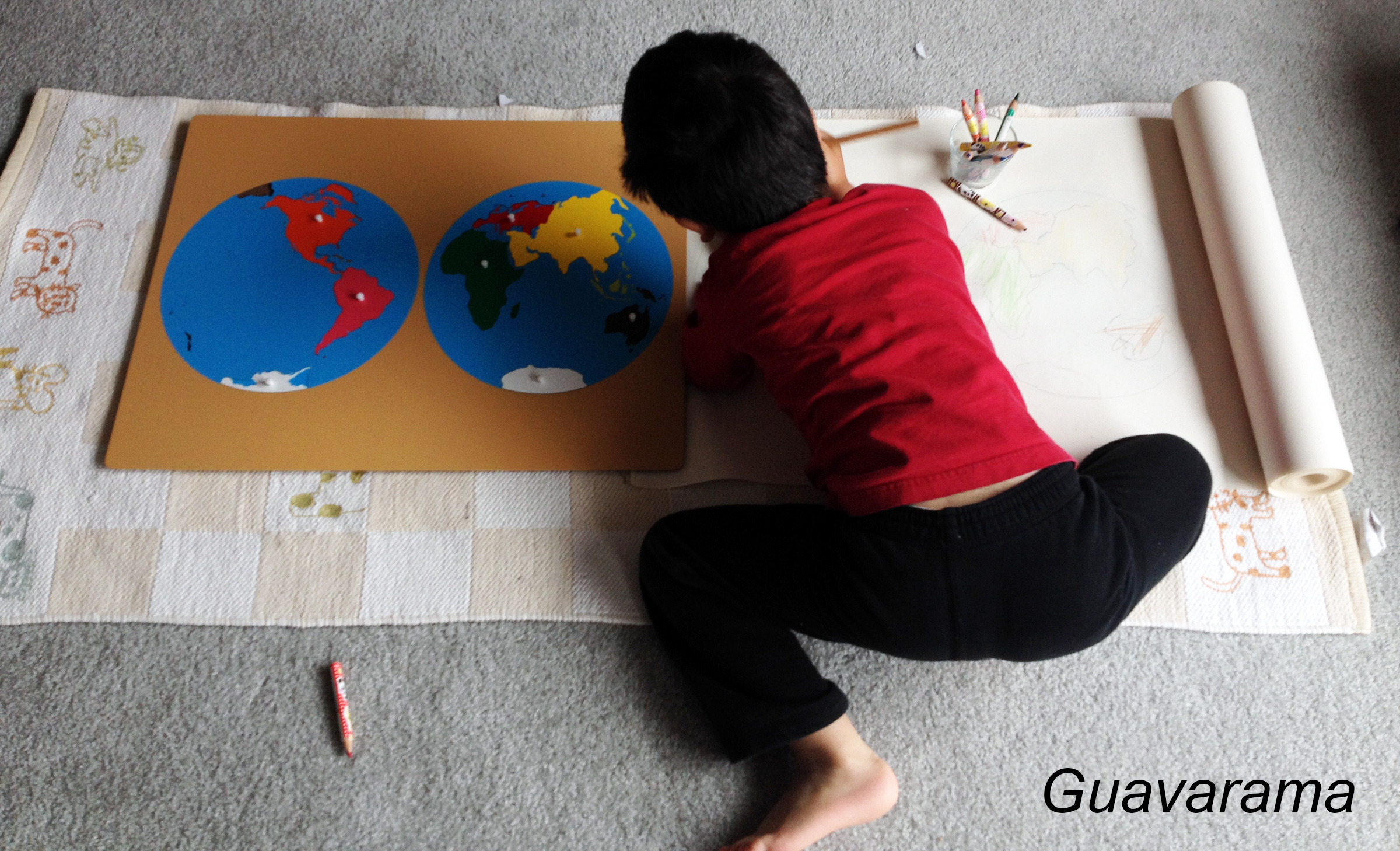
Last semester, I managed to present up to cutting the globe. We learned the Continent Song in Chinese. But Astroboy wasn’t really interested in any followup work. Today, I tried to do a more classical presentation again. I placed each puzzle onto the control chart and named them while he watched. With my help (he’s still not steady with the pencils and tracing), he traced and colored all of the continents. But he wasn’t really getting the names of the continents. So finally, I started telling him stories. I told him that piranhas live in South America. We live in North America, etc. Much like Thumper at this age, the piranhas fascinated him. And with a few iterations he remembered the names more.
I was able to leave him to work half way through. Horray! Some concentration! He was so proud of his work and requested that it be hung on the staircase wall just like his sister’s Solar System chart.
Monday, he wanted a more advanced map work. He first tried to draw it without the map frame, then ended up trying to draw the map without the control map underneath. It was a bit of a hard work, plus with his sister also in the classroom, he was super distracted. He wanted to draw 10 piranhas (食人魚) eating the hands of a big monster (大怪獸). Oh and yes, piranhas in Chinese sound way more scary than in English. It literally mean a fish that eats people.

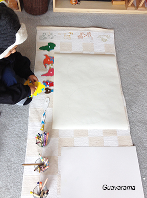
On the other hand, watching him work made Thumper also request some map work. For her, we learned all the names of the states in Australia, plus Papa New Guinea, New Zealand, Pacific Ocean, and Indian Ocean. Since she’s older, we placed labels and she needs to write them in when she’s done coloring. She spent all day on this in between my squaring presentations, with long bouts of concentration. Thumper very much enjoyed the name Papua New Guinea in Chinese. It’s almost a tongue twister. AND it’s different transliteration between English and Chinese. It’s pronounced “ghi-ni-ya” in Chinese instead of “ghi-ni”.
I will need to follow up with some geography activity. Right now, I don’t even know where to start. The possibilities are endless.
These types of work are following my change in direction in learning characters. I’m hoping Thumper gets more practice with reading characters doing subject studies rather than language arts.
Oh, and I got the roll of paper to draw on from Ikea.
Continent Song
Do you now the Continent Song in Chinese? I think there are different versions depending on how you want to order the continents.
An interesting thing about continents is that in Taiwan, they learn it as 大洋洲, Oceania, not 澳洲, Australia. So when I made my materials, I made it that way and I also told Thumper that different countries call it by different names.
告訴我有幾個洲,告訴我有幾個洲,告訴我地球有幾個洲。
北美洲,南美洲,歐洲,亞洲,還有非洲。
不要忘了 大洋洲,不要忘了南極洲.
告訴我有幾個洲,告訴我有幾個洲,告訴我地球有幾個洲。
Countries in Oceania
There are may more countries in Oceania than what is on the Montessori map. So I just translated the ones off of another material website. I spent a lot of time researching because of the different ways people can name the continents. And often you could have the web saying one thing but then educational materials saying another. I also wouldn’t be surprised if they have different names in China vs Taiwan. I made labels for:
- Oceania 大洋洲
- Australia 澳洲
- Papua New Guinea 巴布亞新幾內亞
- Solomon Islands 所羅門群島
- New Caledonia 新喀里多尼亞
- Fiji 斐濟
- Vanuatu 萬那杜
- Western Australia 西澳洲
- Northern Territory 北領地
- Queensland 昆士蘭
- New South Wales 新南威爾斯
- Tasmania 塔斯馬尼亞
- South Australia 南澳州
- Victoria 維多利亞
- Australian Capital Territory 首都領地
I was kind of torn about the need for Thumper to be learning these names in Chinese. Because their names sound so much like it’s translated from English than a translation of however it’s pronounced by the people of that country.
But, I think it will at least give her experience translating names between English and Chinese. Hopefully a few Chinese names will stick and become, in her mind, just another name for a country. Much like how it is for me and the continent names. This will save her the translating step. Often for us English speakers, we have to think hard when we hear an English name in Chinese, rack our brain and try to figure out what it is trying to be in English.